39 Hidden Gems on Fuerteventura Insider Tipps by Locals

39 Hidden Gems on Fuerteventura detailed Insider Tips by Locals
Our hidden gems Fuerteventura guide starts where the postcards end. Everyone knows the dunes of Corralejo and the lagoon at Sotavento, but the island holds far more: a volcano crater with a view straight down into sulphur-yellow rock, caves in some of the oldest rock of the Canaries, a former capital that time has barely touched, and beaches you may have to yourself. We have lived on Fuerteventura for more than 30 years. These are our 39 favourite hidden gems, sorted from north to south: 12 in the north, 10 in the centre and 17 in the south.
Each entry is short, and the link at the end leads to our detailed page with directions and tips. Please note: until further notice, these detail pages are only available in German (German) – we are working on the English versions. In the meantime, your browser can translate them for you.
Before you go
Most of these places are easiest to reach by rental car. Our rental car overview (German) compares the providers and their offices, and our 7 road trips show you how to combine the places. Driving is on the right, as in the rest of Spain.
The trade wind blows almost all year round, so take a jacket even on sunny days. Several places depend on the tide: Los Charcos, Aguas Verdes, Roque del Moro and Playa de los Ojos are best visited at low tide. Check the tides before you set off: this wisuki.com map shows the whole island, and a click on the nearest spot gives you the tide table. Opening days and conditions can change, so please check before you go. In an emergency, call 112.
The North 12 hidden gems beyond the dunes
The north is more varied than it first appears. Everyone knows the dunes of Corralejo and the lighthouse at El Cotillo. But look closer and you find the sacred mountain of the island’s first inhabitants, a perfectly preserved volcano crater, a colonial mansion with ornate wooden balconies and a west coast with natural rock pools that few people know. Twelve hidden gems, from Lobos to Aguas Verdes.


Corralejo and Isla de Lobos – more than dunes
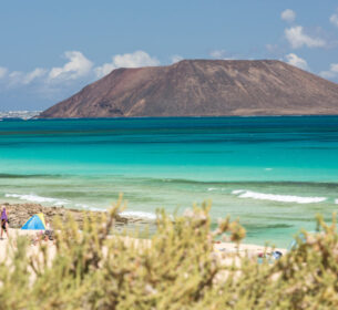
Just off Corralejo lies the uninhabited sister island of Isla de Lobos: a nature reserve without cars, about 15 minutes away by water taxi. Climb the small volcano crater of Montaña de la Caldera in 30 minutes and you can see both islands at once. On the coast near Corralejo, twelve kilometres of moving dunes form a Sahara-like landscape that shifts with the wind – no hotel, no kiosk, just sand, wind and sea.
Isla de Lobos – nature reserve, Playa de la Concha for snorkelling, 30-minute climb up the volcano crater. (German)
Grandes Playas and Dunes of Corralejo – twelve kilometres of white sand with moving dunes behind it, a protected landscape and one of the most impressive natural sights of the Canaries. (German)
Popcorn Beach (Playa del Bajo de la Burra) – no sand here, but white rhodoliths that look like popcorn. Taking any home is strictly forbidden. (German)


El Cotillo – lagoons and lighthouse
El Cotillo is the quieter side of the north: an old fishing harbour, the west coast, and north of the village a chain of lagoons protected from the open Atlantic by lava reefs. At low tide the rock basins turn into crystal-clear natural pools, ideal for families and anyone looking for peace.
Playa de Los Charcos – at low tide the rock basins at the foot of the lighthouse become shallow, crystal-clear natural pools. Unspoilt and almost always empty. (German)
Lagunas del Charco – the famous Playa de la Concha: horseshoe-shaped, powder-white sand and calm turquoise water. Ideal for families and snorkellers. (German)
Faro de Tostón – the red-and-white striped lighthouse about 4 km north of El Cotillo, with a small fishing museum and a real whale skeleton at the entrance. At night one of the darkest starry skies on the island. (German)


The interior – volcanoes, markets and a sacred mountain
Behind the coast a different world begins: a perfectly preserved volcano crater, a relaxed village with a Saturday market, a colonial mansion and the sacred mountain of the island’s first inhabitants, all within a few kilometres of each other.
Calderón Hondo near Lajares – a 70-metre-deep, perfectly round crater in sulphur yellow, red and black, with a viewing platform right above the abyss. On the way you may meet Barbary ground squirrels – please do not feed them. (German)
Lajares – Saturday market and windmills – on Saturdays the village square turns into a crafts market with live music, and behind it stand two historic windmills for a photo in the evening light. (German)
La Oliva – Casa de los Coroneles – a grand colonial mansion with ornate wooden balconies, for generations the seat of the island’s colonels and the centre of power in the north. (German)
Mirador de Vallebrón – one of the lesser-known viewpoints of the north, with views across the plain of La Oliva to the Montaña de Tindaya. A perfect combination with the Tindaya walk. (German)
Montaña de Tindaya – the sacred mountain of the island’s first inhabitants, a 400-metre trachyte monolith with more than 300 engravings on its summit. Circular walk around the foot: about 4 km, 1.5 hours. (German)
Aguas Verdes – the wild west coast
On the west coast north of Ajuy, six kilometres of lava cliffs with natural rock basins stretch along the Atlantic. At low tide they fill with emerald-green sea water – no kiosk, no facilities, just raw nature.
Aguas Verdes – natural pools – six kilometres of lava cliffs with rock basins, accessible only at low tide. Sturdy shoes are a must. (German)
How to explore the north
Most of these places lie along a line between Corralejo and El Cotillo, and the interior is reachable by short detours from the FV-10. If you start early at Calderón Hondo, you can continue via Lajares and La Oliva to Tindaya and end the day at the lagoons or the lighthouse in El Cotillo. Aguas Verdes lies a little apart on the west coast – best combined with a visit to Ajuy.
The Centre 10 hidden gems from the Fuerteventura of old
The centre of the island is what Fuerteventura was before tourism arrived: farming, history, colonial architecture and mountain passes. Betancuria was the first capital of the Canary Islands and remained the capital of Fuerteventura until 1834. The Barranco de las Peñitas is among the most impressive gorges of the archipelago. The Salinas del Carmen are the island’s last working salt flats, with a whale skeleton right by the sea. Ten good reasons to leave the FV-2 behind.


On the way into the interior, two mountain passes lead past bronze statues of the last indigenous kings and a viewpoint with a café designed by César Manrique and a magnificent panorama. Then you reach the former capital, protected as a historic site and barely changed in more than 600 years.
Cuevas de Los Estancos – an unmarked insider spot in the backcountry: lava tunnels and rock caves in a fossil canyon of pale sand. Bring an offline map. (German)
Mirador de Guise y Ayose – two bronze statues, more than 4 metres tall, of the island’s last indigenous kings on the windswept mountain pass, a classic photo stop. (German)
Mirador de Morro Velosa – designed by César Manrique at 669 metres, with a 360-degree panorama. On the way up: fresh Majorero cheese from Granja la Villa. (German)


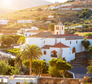
Betancuria – the first capital of the Canary Islands (1404) and capital of Fuerteventura until 1834, a protected historic town. If you arrive before 11 am or after 3:30 pm, you will have the village almost to yourself. (German)
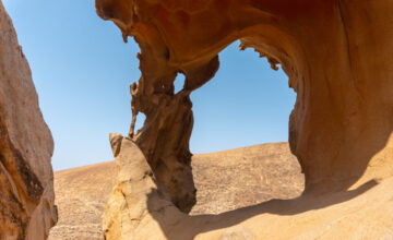
Barranco de las Peñitas and Arco de las Peñitas – the classic walk of the interior, starting in Vega de Río Palmas: 4.5 km, 2 hours, ending at a huge natural rock arch. Sturdy shoes are a must. (German)
Mirador de las Peñitas – an official viewpoint right on the FV-30 with panoramic views over the palm valley, no climb needed. (German)
Antigua – windmill and Museo del Queso Majorero – restored windmill, cheese museum with tasting, cactus garden. (German)


Torre de San Buenaventura – Caleta de Fuste – round watchtower from 1740 right at the marina, today part of a hotel complex. (German)
On the east coast south of Caleta de Fuste lie the island’s last working salt flats with a huge whale skeleton by the water. Inland, the Ecomuseo La Alcogida shows what Canarian village life really looked like, with craftspeople at work. And in the backcountry hides a little-known lava tunnel canyon.
Salinas del Carmen – the island’s last working salt flats, a modern museum about salt production, and a huge whale skeleton by the water as a landmark. (German)
Ecomuseo La Alcogida (Tefía) – seven restored farmhouses, craftspeople at work and freshly baked aniseed bread from a wood-fired oven. An authentic look at traditional island life. (German)
The South - 17 hidden gems from Ajuy to the end of the Jandía peninsula
How to explore the south
The south cannot be done in a day. Cofete, Roque del Moro, the lighthouse and Playa de los Ojos are the big day adventure over the gravel track – best all four together. Pájara, Ajuy and Sicasumbre make a west coast circuit, and Costa Calma and La Pared an easy half-day trip.


Cuevas de Ajuy – from the black volcanic beach Playa de los Muertos, a cliff path leads to two huge sea caves. The rocks here are among the oldest in the Canary Islands. Bring a torch and do not climb down in heavy swell. (German)
Pájara – church with the Aztec-style portal – a plain village church whose portal still puzzles historians: snakes, faces that look Native American, feather ornaments. Stone carvings that are unique in the Canaries. Free entry. (German)
Mirador Astronómico de Sicasumbre – the island’s first official stargazing viewpoint on the FV-605. By day a 360-degree panorama of volcanoes, at night dark skies with no light and no noise, only stars. Bring a warm jacket. (German)
Faro de la Entallada near Las Playitas – built in 1953 from dark volcanic stone in Moorish style, on a cliff 200 metres above the Atlantic and less than 100 km from the African coast. Free to visit; opening days can change, so check before you go. (German)


La Pared – west coast and beach scenery – two contrasting beaches below huge sandstone cliffs, the surf hotspot of the south. Remains of the old stone wall that once divided the island into two kingdoms. A beautiful place for sunset. (German)
Oasis Wildlife Fuerteventura, La Lajita – a wildlife and botanical park at the edge of La Lajita: more than 3,000 animals, a huge cactus garden, camel safaris and animal shows. About 10 minutes from Costa Calma. (German)
1STone Art and Design, Costa Calma – since 1997 the island’s only gemstone workshop: handmade one-of-a-kind pieces from the studio in Costa Calma, found in the store at CC El Palmeral, Local 8. No mass production, no imports. (German)
Playa de la Barca and Sotavento lagoon – at high tide a turquoise sea lake, at low tide an endless sand walk. René Egli and the ION Club sit right on the lagoon, and this is where the windsurf world cup takes place. (German)


Playa de la Barca and Sotavento lagoon – at high tide a turquoise sea lake, at low tide an endless sand walk. René Egli and the ION Club sit right on the lagoon, and this is where the windsurf world cup takes place. (German)
Mirador del Salmo – a painted wooden bench at the cliff edge with the best-known view of the Sotavento lagoon from above, one of the most photographed places on the island. Strong trade wind: hold on to the car door and bring a jacket. There is no toilet, kiosk or shade. (German)
Mirador de los Canarios – the best-hidden viewpoint of the south. A gravel track, then on foot up to the ridge, and the view opens suddenly onto the long Cofete beach far below, with both coasts in sight at once. (German)
Salt marshes and Faro de Morro Jable – the 60-metre white lighthouse in the middle of the protected salt marshes of the Saladar de Jandía. At certain tides the sea floods the marsh, which is full of salt plants and migratory birds. A raised boardwalk leads through it, please stay on it. Beautiful from the promenade. (German)


Pico de la Zarza – the highest mountain on Fuerteventura at 812 metres. The walk starts by the golf course in Jandía, about 13 km there and back, 4 to 6 hours, no shade. At the top, a sheer summit edge above Cofete. Start early and bring plenty of water. (German)
Mirador de Morro Jable and harbour – the viewing spot by the church above the old town of Morro Jable, with the bronze statue of the three fishermen. Far below lies the harbour with clear water in which large stingrays glide. (German)
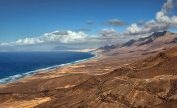
Mirador and Playa de Cofete – the pass on the gravel track: suddenly the landscape opens and a wild beach lies far below, with Villa Winter behind it. No swimming because of strong currents, but a truly impressive beach walk. (German)
Roque del Moro – a 50-metre rock stack rising out of the ocean at the north end of Cofete beach, with a natural tidal pool at its foot. One of the most photogenic motifs of the Canaries, reachable only at low tide. (German)
Faro de Punta de Jandía and El Puertito – one of the oldest lighthouses in the Canaries, built in 1864 at the end of the gravel track on the south-west tip. Next to it the tiny fishing village of El Puertito with wonderfully fresh fish and the feeling of standing at the end of the world. (German)
Playa de los Ojos – a tiny hidden cove south of Cofete, reached by a steep wooden staircase. At low tide: sandy beach and sea caves in ochre sandstone. At high tide the water rises to the cliff – timing is everything, so check the tide table first. (German)

Warum InsiderFuerteventura?
Weil es einen Unterschied macht ob jemand zwei Wochen Urlaub auf Fuerteventura hatte — oder seit 30 Jahren dort lebt.
Wir kennen die Strände die kein Reiseführer erwähnt. Die Restaurants wo die Einheimischen essen. Die Spots die nur funktionieren wenn man weiß wann die Flut kommt. Die Abkürzungen, die Geheimtipps, die Fehler die man als Urlauber macht wenn man die Insel nicht kennt.
InsiderFuerteventura ist kein Reiseblog. Es ist das was wir unseren Gästen erzählen würden wenn wir Zeit hätten — jetzt aufgeschrieben.
Interaktive Inselkarte
Inside Fuerteventura — Insider Karte
Latest from the Blog

Sehenswürdigkeiten Fuerteventura 7 Touren Auto
Die schönsten Sehenswürdigkeiten Fuerteventuras liegen nicht am Strand, sondern im Inselinneren, an […]